
Walk a Pasco Street
A useful Pasco County street directory search moves from a modern address to records with stronger identity keys. The Property Appraiser Records Search is the best first stop because its address mode can return one parcel or a run of parcels along the same road. A result identifies the assessed owner, physical address, owner mailing address, parcel number, jurisdiction, legal description, and sales links. Those facts establish the property record. They do not prove who sleeps there today.
Keep each finding tied to its source. The physical, or situs, address locates the assessed land. The mailing address is where the owner receives tax mail and may be elsewhere. A deed proves a transfer of title, while a permit dates work at the site. The sequence below turns a broad address search into a record trail without overstating any one result.
- Enter the street number and base street name in the Property Appraiser search. For a whole-road browse, omit the number and sort the result by address.
- Open a parcel card and copy the parcel ID, physical address, jurisdiction, legal description, and sales book and page.
- Use Pasco Mapper to inspect lots that touch the road. Click mapped parcels and pass their IDs back to the parcel search.
- Open the recorded book-and-page link, then follow sellers and buyers through the Clerk's deed index.
- Add permit, enforcement, and lawful public-voter evidence only for the narrow question each source can answer.
Browse Pasco by Address
The Property Appraiser offers six search routes: Parcel ID, Name, Physical Address, O.R. Book/Page, Subdivision Name, and Recent Sales. Address results display Parcel, Name, and Address columns, with groups of 10, 50, 100, 500, or 1,000 results. Leaving the house number blank turns the street-name field into a practical by-street browse. Shortening the road name can help, but confirm the selected parcel with its full physical address and legal description.
| Search choice | Input | Best use | Check afterward |
|---|---|---|---|
| Physical Address | Number and street name separately | One lot or a whole street | Physical address and jurisdiction |
| Parcel ID | Six-part parcel key | Exact assessed tract | Legal description and map |
| Owner Name | Surname first, no comma | Other parcels under a name | Identity and mailing address |
| O.R. Book/Page | Recorded book and page | Bridge from deed to parcel | Instrument image and parties |
| Subdivision | Recorded subdivision name | Lots sharing a plat | Block, lot, and road frontage |
The card's sales data may take two to six weeks to reflect a recorded market transaction. Treat it as a route to the deed image, not as a live occupancy report. Homestead status can support an owner-occupancy inference under assessment rules, but it cannot name every member of a household.
Note: A tax mailing address may identify an absent owner, an agent, a post office box, or another property, not the parcel occupant.
Map Pasco Street Parcels
Pasco Mapper adds the geography that a result list cannot show. Search or Address Search centers a road. Map Layers reveals the available parcel, address, road, planning, and jurisdiction context. Select Features can gather lots along a short segment, while Table lets the user compare the selected attributes. Measurement and Draw help define the area being studied, but neither creates an official boundary.
Address points and ownership parcels are separate layers. A large apartment site may contain many unit or subaddress points on a single ownership parcel. Conversely, one mailing label may be used across nearby tracts. The map is therefore useful for selecting the right parcel IDs, not for generating a household list. The county Address layer keeps FULL_ADDRESS, ZIP_CODE5, JURISDICTION, MAILING_CITY, and PARCEL_NUMBER as distinct fields. That separation prevents a postal label from being mistaken for city jurisdiction.
- Parcel
- A tract used by the Property Appraiser and GIS as an assessment and map unit.
- Situs address
- The physical address assigned to the parcel, distinct from the owner's tax-mail address.
- Plat
- A recorded map that identifies a subdivision, blocks, lots, roads, and other dedicated areas.
- Criss-cross directory
- A historical directory arranged by street or telephone number rather than only by surname.
Pasco Street Records Compared
No single Pasco County street directory source answers every address question. The parcel roll is strongest for current assessed ownership. GIS supplies location and adjacency. Official Records show named parties to deeds, liens, mortgages, and plats. PascoGateway adds the public chronology of building and enforcement activity. Each source has a different keeper and limit.
| Record Set | Keeper | What It Shows | Access |
|---|---|---|---|
| Certified tax roll | Pasco County Property Appraiser | Assessed owner, mail and situs addresses, exemptions, sales | Free web search and three offices |
| Parcel and address GIS | Pasco County GIS | Parcels, address points, jurisdiction, ZIP, nearby geography | Free Pasco Mapper and data services |
| Deeds, liens, and plats | Pasco County Clerk & Comptroller | Indexed parties, dates, legal description, instrument image | Free index from 1975; counter fallback |
| Building and enforcement | County or municipality | Project, inspection, case, status, and public contacts | PascoGateway for county jurisdiction |
| Public voter extract | Supervisor of Elections | Nonexempt registration fields when lawfully requested | Records request, with protected data removed |
The parcel ID ties the roll to GIS and county permits. Book and page tie a parcel sale to the Clerk's recorded instrument. Street and ZIP fields help group local results, but they are less stable than the legal description. When the online route fails, the Property Appraiser has offices in Dade City, Land O' Lakes, and New Port Richey, and the Clerk maintains Official Records counters in east and west Pasco.
Link Pasco Addresses to Deeds
The Pasco Official Records search is indexed by name, instrument, or book and page, not chiefly by street address. Start from the parcel card's sales book/page link. Confirm that the deed's legal description matches the parcel, then note the buyer, seller, recording date, and instrument number. For a broader name search, enter last name followed by first name with no comma. Date limits and the DEED / PROPERTY TRANSFER document set reduce noise.
The online index begins January 1, 1975. Public index access is free, while ordinary copies cost $1 per page and certification costs $2 per document according to the Clerk fee schedule. Older material requires the separate historical route or staff help. The Clerk's east Official Records office is at 14236 6th Street, Suite 201, Dade City, and the west office is at 8731 Citizens Drive, Suite 220, New Port Richey. Both list weekday hours of 8:30 a.m. to 5 p.m.
In Pasco's form, Party 1 and Party 2 take the place of familiar grantor and grantee labels. Their meaning depends on the document type. Read the image before deciding which party gave or received an interest.
Search Pasco Permits by Street
PascoGateway Building accepts record, party or license, address, parcel, and ZIP criteria without requiring an account for general searches. A result may show record number and type, work description, dates, issuance or status, inspections, and public documents. Older activity may remain under the Permits tab. Certificate-of-occupancy information from before April 2016 may require the archived CO files linked by the county.
Code matters have their own Enforcement search. It supports address, parcel, lot or subdivision, record type, and entered-date filters. Search both systems because a renovation record and an enforcement case answer different questions. First check the parcel's Jurisdiction field. Incorporated places issue and keep their own municipal permits, so PascoGateway is not a complete countywide permit index.
The official county search screens show how address and parcel fields narrow real local records.
View the PascoGateway building search before using the captured interface below.
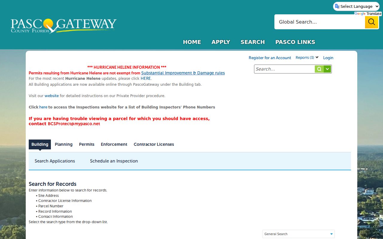
The form confirms that address, parcel, and ZIP can lead into the county's building chronology.
Open the Pasco code enforcement search to compare its street and parcel filters.
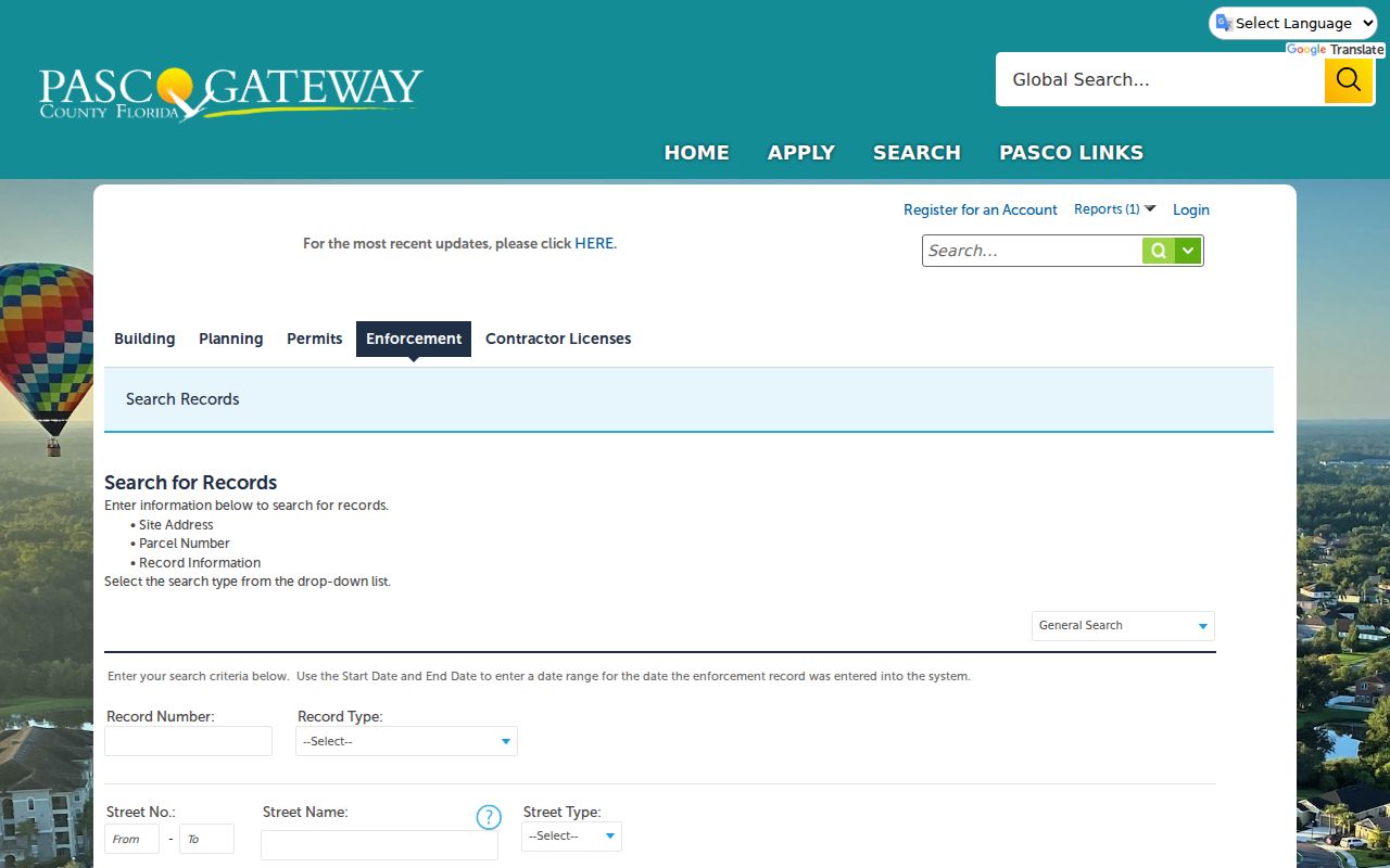
The separate enforcement screen is why one Pasco address should be checked in more than one tab.
Check Pasco Address Authority
The Pasco County Addressing office publishes addressing standards, forms, and current-street resources. This is the right channel when a road name, number, or jurisdiction does not line up across databases. The county's address layer stores mailing city and jurisdiction separately because postal delivery does not determine municipal limits. Lutz, Odessa, Brooksville, and Spring Hill labels can occur on Pasco addresses near county edges.
A street directory result should preserve the exact form shown by the source. Try spelling variants and suffix forms when an older deed or permit will not match. For genealogy, historic postal names such as Hatton, later Dade City, may also matter. Current Addressing staff can clarify modern assignments, but historical name changes may require deeds, plats, newspapers, or directory evidence.
Review Pasco's street naming and addressing resources alongside the captured page.
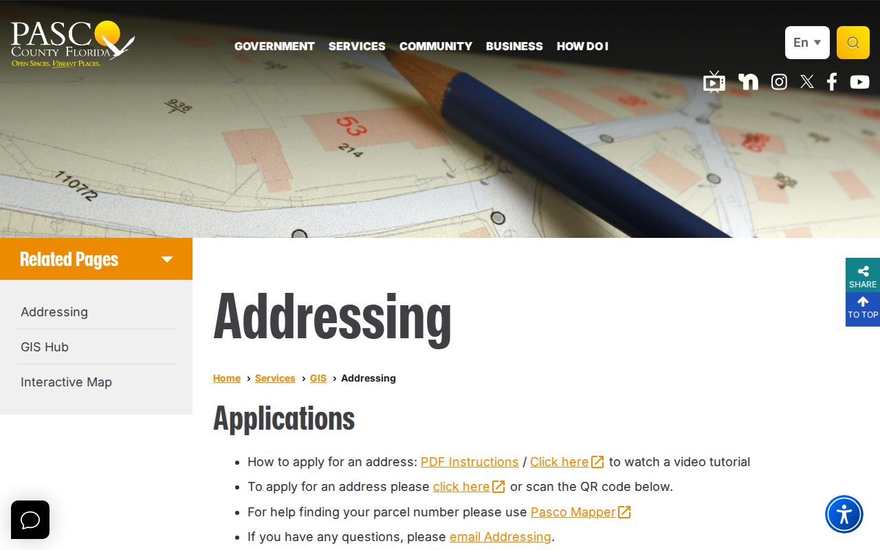
The county resource helps separate a valid current address from the older forms found in recorded and archival material.
Read Pasco Street Instruments
A deed-search result is strongest when its image is read, not just its index row. The record can provide instrument number, document type, recording date and time, book and page, indexed names and roles, and legal text. Images are reproductions of submitted documents, so a hard-to-read scan may reflect the original. Protected information and restricted document classes can also limit what appears on the public web.
Visit the Pasco Clerk Official Records form before comparing the captured search page.
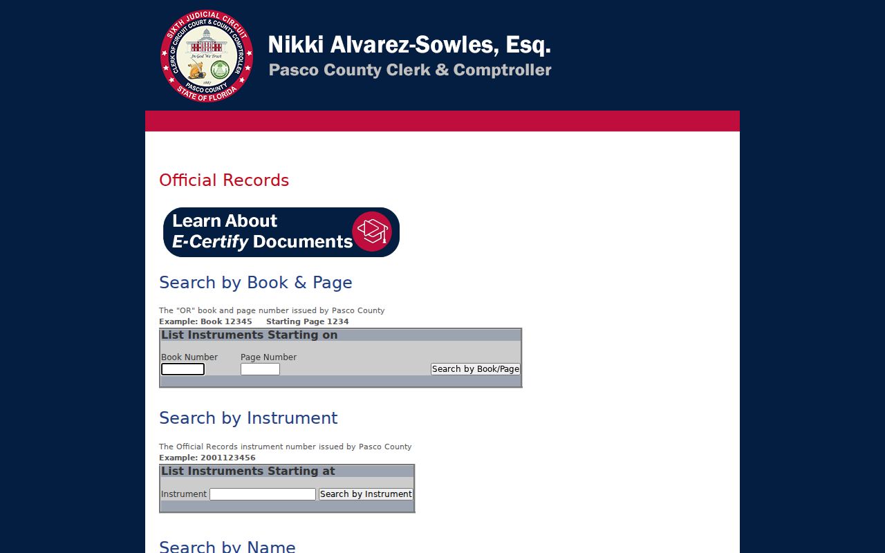
The name and book-page routes shown here are the bridge between a street parcel card and its recorded chain.
Note: Index coverage and image coverage are not identical, so ask a Clerk counter for a record that is indexed but not viewable online.
Pasco Street Directory Limits
A Pasco County street directory built from public property data lists assessed owners, not every resident. Renters, relatives, roommates, and children normally do not appear on the tax roll. A deed also identifies title parties rather than a complete household. Utility customer records and driver-license addresses are not supplied by the parcel or GIS systems. Multi-unit parcels are especially easy to misread because one owner record can sit beneath many apartment address points.
The Pasco voter-status form is for an individual to verify their own status and is not a street-wide directory. A lawful public voter-file request goes through the Supervisor of Elections, with confidential fields and protected voters withheld under Florida law. Voting history shows participation, never a ballot choice. Historical directories and census schedules can support an older occupancy finding, but they still omit people and reflect only the date of that source. For deeper historical collection work, use the Pasco County directory book resources.
Lawful use. Use Pasco County address records only for lawful personal research, civic review, family history, or fraud prevention. Never use them to stalk, harass, threaten, or harm anyone.